
Lon Eifion Circular Route – Groeslon Loop
By Dave Roberts ![]()
on February 19, 2015 No ratings yet.
Posted as a walk in –
Lon Eifion Circular Route – Groeslon Loop
Route Essentials
Route Summary
See the end of the article for local information about parking, public transport facilities, pubs and cafes.
Distance
4.68 kmAscent
43 mTime
Calculate the time using Naismith’s Rule and factor in your own pace.
Start Location
Difficulty
Hazards
Weather Forecast:
Check out our Best Mountain Weather Forecast?
Remember that we cannot outline every single hazard on a walk – it’s up to you to be safe and competent. Read up on Mountain Safety , Navigation and what equipment you’ll need.
Lon Eifion Circular Route – Groeslon Loop Ordnance Survey Map and GPX File Download
Lon Eifion Circular Route – Groeslon Loop
This circular route takes a quiet country lane from Groeslon, a short section along a hamlet that provides both sea and mountain views before returning on quiet country lanes to Penygroes where you rejoin Lon Eifion. It’s designed as a return loop on the Lon Eifion rather than a cycle in it’s own right owing to the length – but still makes a half decent run if you’re in the area.
It can also be used to divert across to Glynllifon from Lon Eifion.
This variation starts from Y Groeslon, which has free parking next to the Lon Eifion.
1 Start the route behind the Pennionnyn pub, and follow the track until it turns back on itself to cross under the main road.
2 Just after passing under the main road, there’s a gap in the fence that allows you to join the minor road – follow this away from the main road. It’s a narrow lane, so you’ll need to stop for any cars you meet.
3 The lane after 1km reaches the main A499 road, and while you can simply turn left on the Cycletrack, you can continue across the main road and towards the hamlet of Ty’n Lon on quiet lanes.

4 Follow the lane, and turn a sharp left to pass the handful of houses an chapel that make up the settlement. It’s a well positioned hamlet, as there are views to the sea in one direction and the mountains in the other. The cycletracks can be a bit devoid of views in some sections, so this gives you some idea of the landscape you’re passing through.

5 Continue to the village, and follow the tarmac road left rather than the dirt track ahead (as this is a dead end – and although there’s a passable cv bridleway across to the A499 from here, it’s not suited). Cross the A499 and continue right along the cycletrack until you reach a road junction.

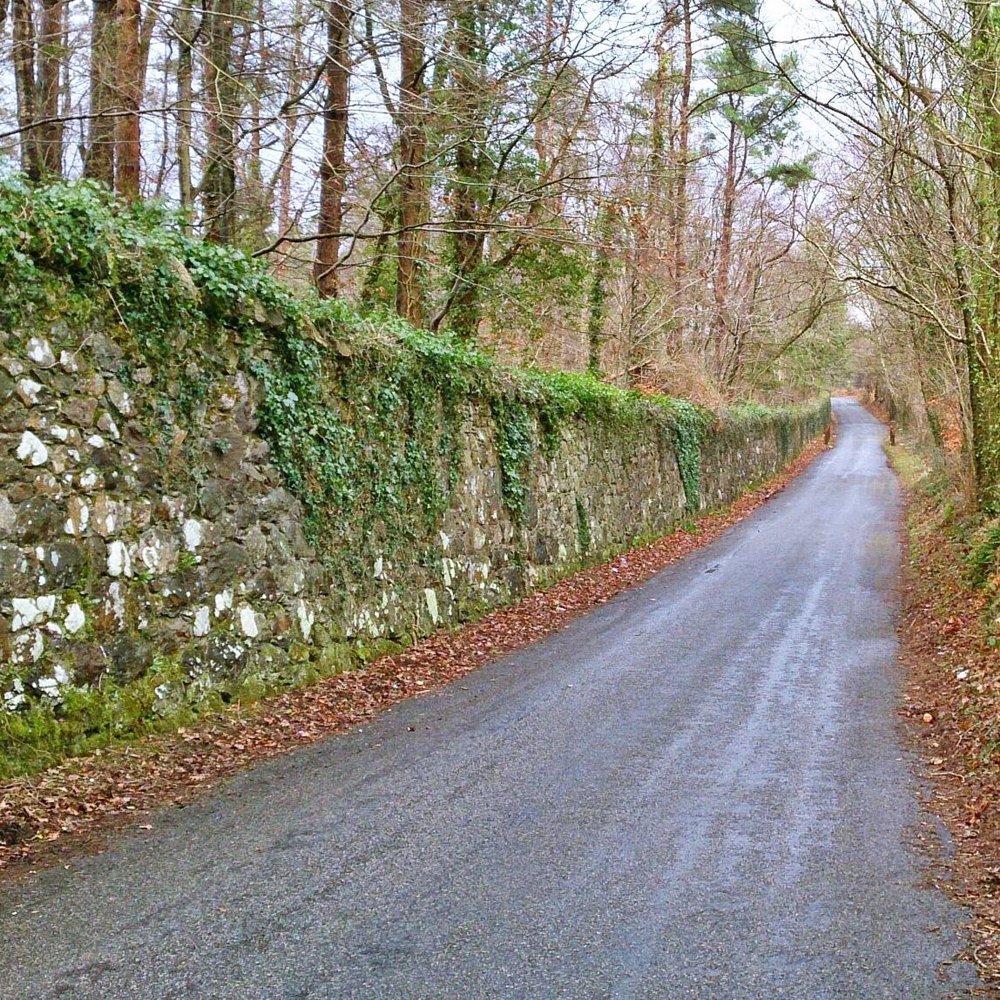
6 You can continue along the cylcetrack to Glynllifon, or Llandwrog if you wanted, but we’re going to follow the minor road left. There’s a bit of a pull on this initially (it might make the route better in reverse!) but it soon levels out. You will pass a few cars on this route, and it can be narrow in places so care will be needed. It follows the Glynllifon estate wall all the way to Groeslon.
7 After 1.5km, you’ll arrive at a roundabout. There’s a crossing point, and just beyond this you’ll be back at the start. You can cycle the pavement here, but we weren’t 100% certain if this was a mixed use path. Walk the bike if that bothers you.
The Lon Eifion Circular Route – via Pontllyfni and Pont y Cim offers a longer alternative, and you could combine both for a more interesting variation on the usual Lon Eifion.
Local Information and Recommended Maps and Guidebooks
Route Summary:
Route Start Location:
| Distance |
Ascent |
Time |
| 4.68 km | 43 m |
Calculate the time using Naismith’s Rule and factor in your own pace.
Activivity Type:
Summits and Places on this Route
Facilities
Check out the businesses nearby for more places to stay and drink.
Hazards
Remember that we cannot outline every single hazard on a walk – it’s up to you to be safe and competent. Read up on Mountain Safety , Navigation and what equipment you’ll need.
Parking :
Public Transport:
Guidebooks:
![]()
Dave Roberts
More Posts by Dave Roberts

Tryfan South Ridge Grade 1 Scramble

Walk to Llyn Llywelyn from Rhyd Ddu
